


If you’re a responsible and safe driver, it’s important to be aware of the speed limit. This is something that should be easy to keep in mind, but some places don’t have speed limit signs posted nearly as frequently as they should. You may find yourself driving for miles with no idea what the speed limit is. Google Maps will soon be able to help with this problem in more areas in the United States.
Back in 2017, Google started testing speed limit markers in San Francisco and Rio de Janeiro. However, late last year they downgraded the accuracy of these speed limit markers, which made them less reliable. The good news is it seems like Google is rolling out this feature once again to a wider audience. Users in New York City, Los Angeles, and Minnesota have spotted the speed limit markers in Google Maps. You will see the marker show up in the bottom left corner while using turn-by-turn navigation.
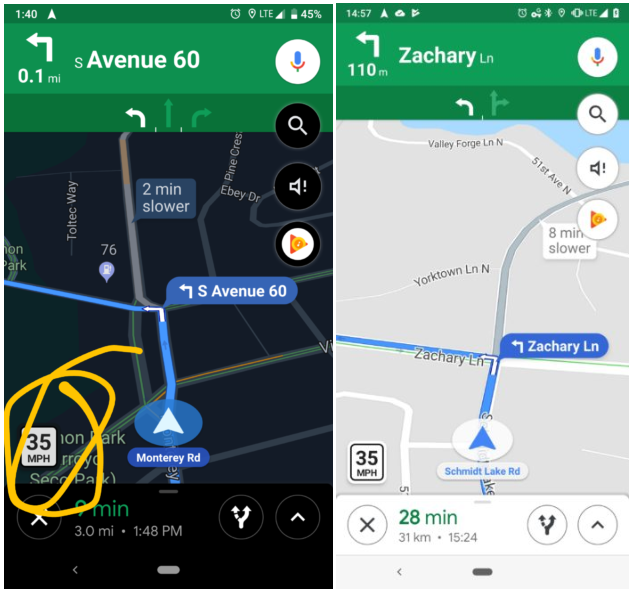
We haven’t seen any Google Maps app updates lately, which means this is a feature being rolled out via a server-side switch. Also, depending on your area, it may never be available. High population areas are likely to have more reliable speed limit data. Let us know if you’re seeing speed limit markers in Google Maps!


